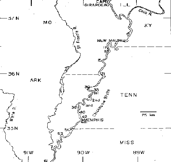
FIG. 2. Map of the epicentral area of the Mississippi Valley earthquakes of 1811 and 1812. The numbers 10 through 61 along the Mississippi River refer to islands in the river, as used by navigators of riverboats and as referred to in some of the newspaper accounts of the earthquakes. The epicenter of the December 16, 1811 earthquake at 08h15m GMT was near the southern end of the lake formed by the St. Francis River, about 50 km west of the second Chicksaw Bluff. (Map after Humphreys and Abbott, 1861, Plate II.)