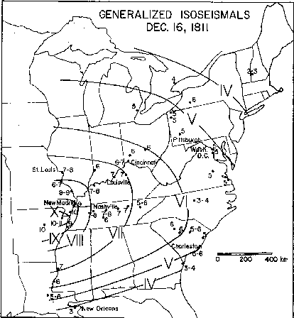
FIG. 1. Generalized isoseismal map of the earthquake of December 16, 1811 at 08h15m GMT. MM intensity values at individual points are given in Arabic numerals (see Table 1 for sources of information). The isoseisms, labeled with Roman numerals, indicate the outer bound of the region of specified intensity.