 |
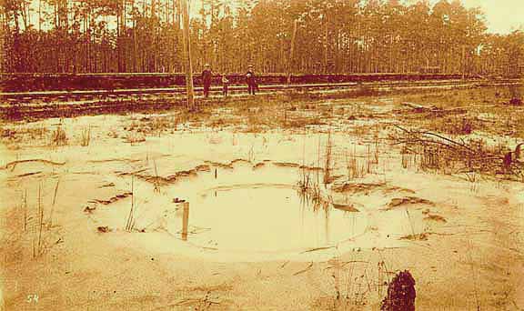 |
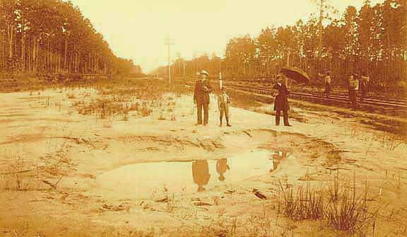
| Long Geyser (upper photo) and Round Geyser (lower photo), Ten Mile Hill. These two pictures are from "George L. Cook's Earthquake Views, nos. 53 and 54." Manigault writes , "Two mud spouts or craterlets at Ten Mile Hill on Southern Carolina Railway near Charleston. The surface around is covered by the overflow to the depth fo a foot to eighteen inches. Depth of water in craterlet a few inches." (South Caroliniana Library Archives) |
| [Next Image] | [Previous Image] | [Charleston Earthquake] | [Earthquake Center] |